
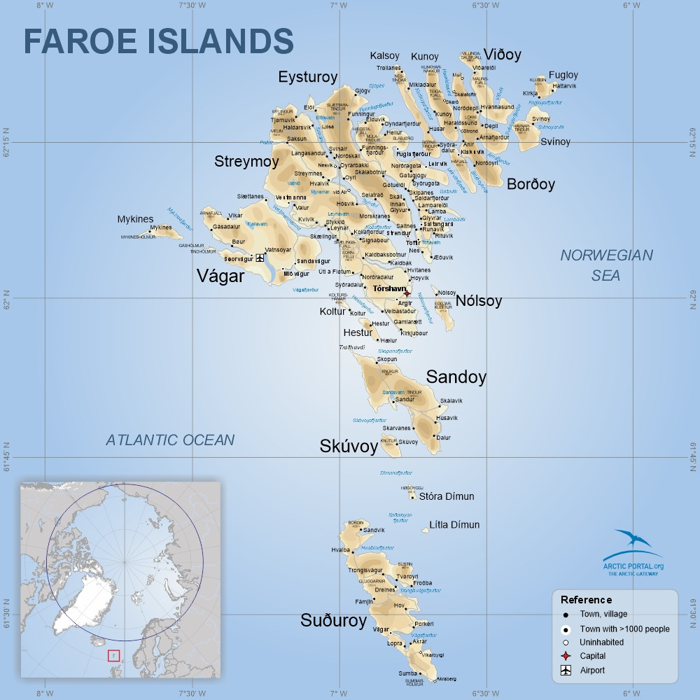
Faroe Islands
This is a map of the Faroe Islands. The Faroe Islands, a cluster of 18 rugged islands, lie between the Norwegian Sea and the North Atlantic, about halfway between Iceland and Norway at coordinates 62°N, 7°W.
Their isolated location and dramatic landscapes include Europe’s highest sea cliffs, rolling green hills, fjords, small lakes, rivers, and 1,117 kilometers of coastline across 1,393 km2. The highest point is Slættaratindur at 882 m on the island of Eysturoy.
Tórshavn is the capital located on the island of Streymoy with about 23 thousand inhabitants.
© Arctic Portal 2006-2026
Last updated: February 2025
Source
Arctic Portal