
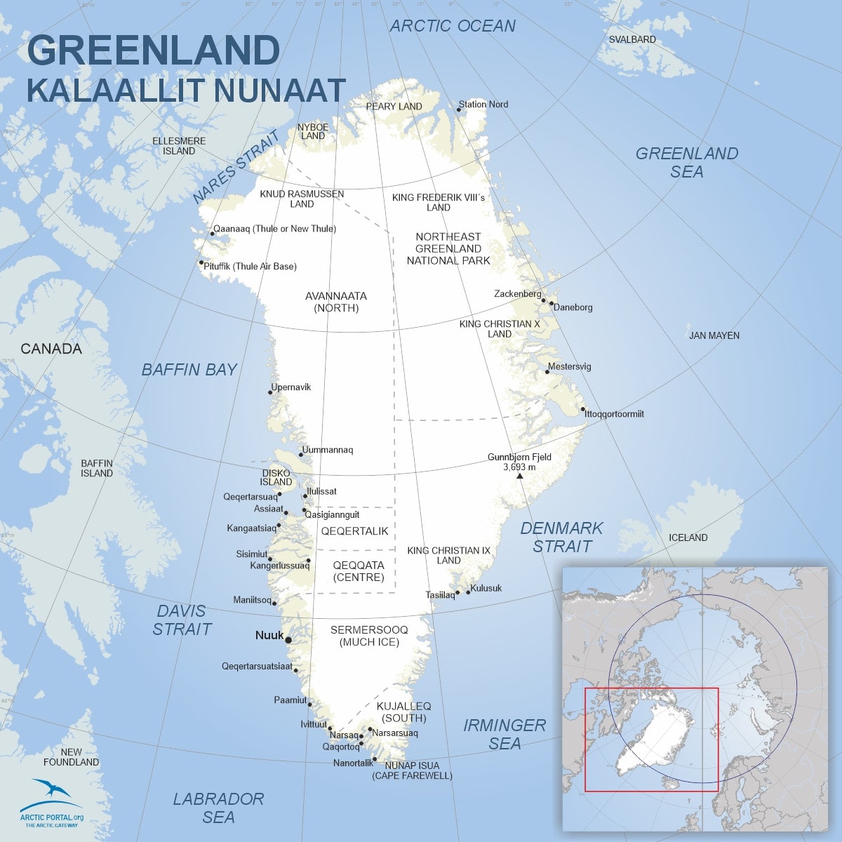
Greenland
This is a map of Greenland. Greenland is about 2,17M km2. Inland ice and glaciers cover about 1,76M km2. Two-thirds of the country lies above the Arctic Circle, experiencing a frigid climate year-round. The island's unfrozen areas are characterized by tundra landscapes, with permafrost lying beneath much of the surface. The coastline, mostly rocky, stretches for approximately 39,330 kilometers (24,430 miles), making it one of the longest coastlines globally. Highest point is Gunnbjørn's Fjeld 3,693 m.
Approximately half of Greenland's landmass is designated as the National Park of Greenland, being both the island's sole national park and the largest national park in the world. At 0,97M km2 (0,37M mi2), the park covers most of the NE section of the island.
© Arctic Portal 2006-2026
Last updated: February 2025
Source
Arctic Portal