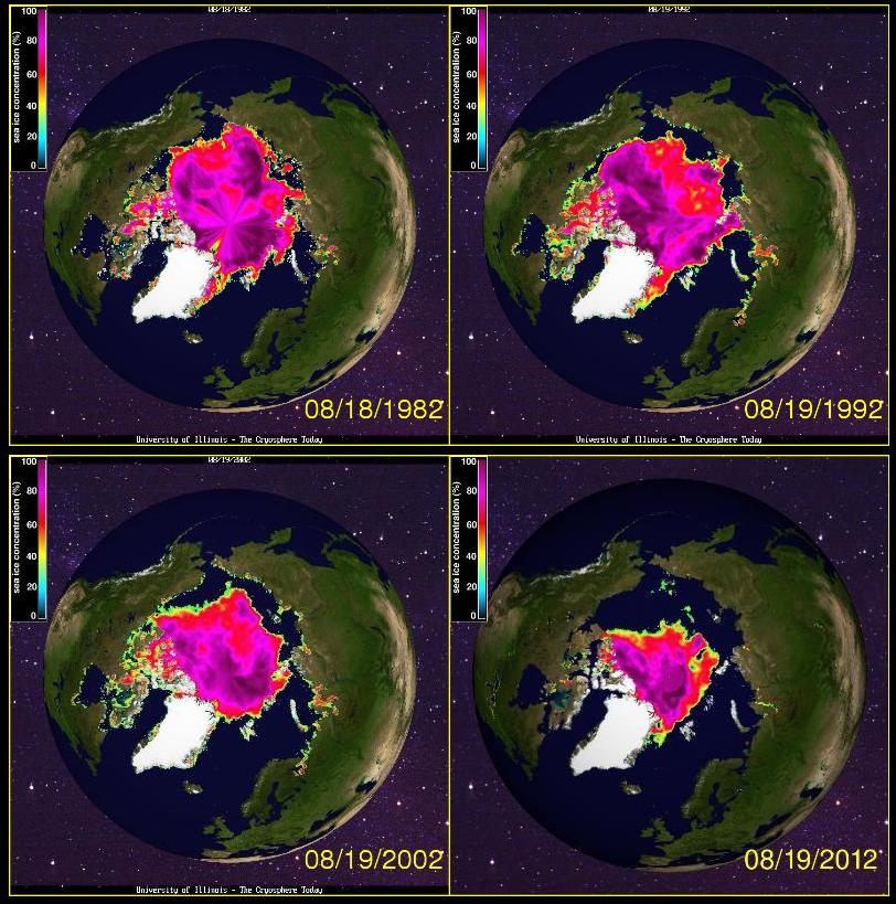
A website by the university of Illinois, USA, allows users to compare sea ice extent between exact dates since 1979.
The user-friendly website clearly demonstrates the sea ice extent with data from the National Center for Environmental Prediction/NOAA, NSIDC, U. Bremen.
By selecting two different dates comparison can be made between pictures that show the extent.
The picture on the right actually shows four pictures, but the system compares two. The picture, expandable by clicking on it, shows the sea ice on August 19th in 1982, 1992, 2002 and 2012.
Comparing even the last 10 years shows incredible changes in the sea ice extent.
The website also demonstrates all the pictures in a video showing the extent from 1978-2006 here.
Click here to see and test the system.
Source:
CryoSphere Today

