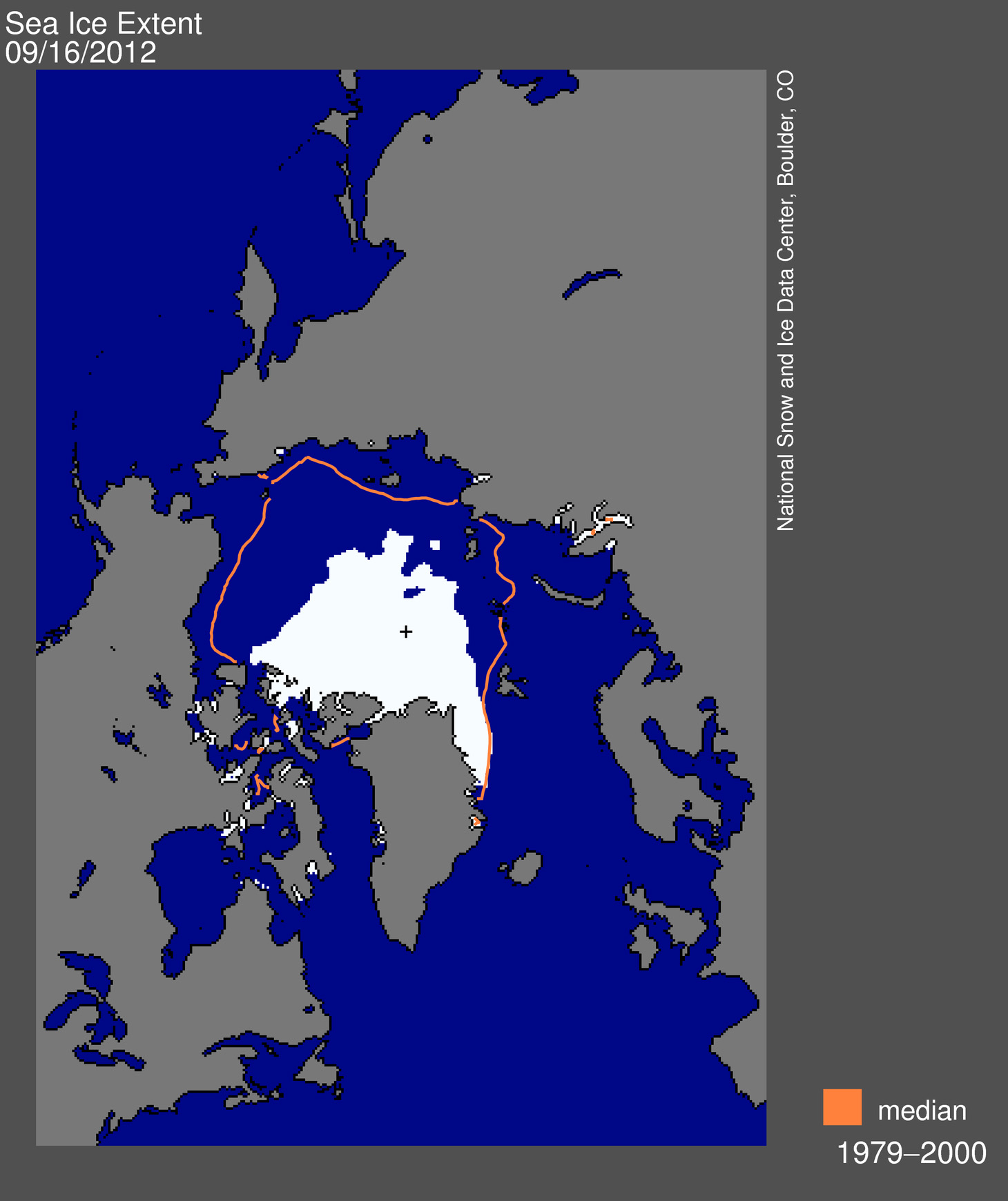
The summer sea ice is increasing again as winter looms but recorded its lowest ever extent since satellite measurements began in 1979. The ice on September 16th was significantly lower than the previous record year of 2007.

On September 16, 2012 sea ice extent dropped to 3.41 million square kilometers, 760,000 square kilometers below the previous record minimum extent in the satellite record, which occurred on September 18, 2007.
That means there less ice in the Arctic which would cover all of Norway, Denmark and Finland combined.
The National Snow and Ice Data Center reports that in response to the setting sun and falling temperatures, ice extent will now climb through autumn and winter. However, a shift in wind patterns or a period of late season melt could still push the ice extent lower. The minimum extent was reached three days later than the 1979 to 2000 average minimum date of September 13.
This year's minimum is 18% below 2007 and 49% below the 1979 to 2000 average.
Overall there was a loss of 11.83 million square kilometers (4.57 million square miles) of ice since the maximum extent occurred on March 20, 2012, which is the largest summer ice extent loss in the satellite record, more than one million square kilometers greater than in any previous year.
Source:
