
News
New tool to map the Arctic now available
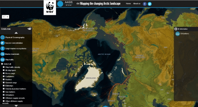
Few days ago WWF launched ArkGIS (Arctic Geographical Information System) – a free, interactive mapping platform that combines and integrates existing data about the environment and human activity in the Arctic.
By releasing a new web tool mapping both nature and activities, WWF hopes to be able to make relevant information universally available – in a very visible manner.
The web-platform allows any user to download pre-made maps and videos, as well as developing customized maps on their own, using an interactive map service.
ArkGIS is a project initiated and managed by WWF, but it brings together data from a host of information providers, including several Arctic Council working groups, the Institute of Marine Research, and the Norwegian Coastal Administration. Map layers to date include 368 identified areas of heightened ecological significance, and Arctic ship traffic, ice coverage, and bathymetry.
Please click here to view the ArkGIS. Click here to connect to the Arctic Portal Mapping System.
Source